Boundaries & intended use
A-5 zoning and Rural-5 future land use are subject to county review for a proposed use. Wetlands, flood conditions, boundaries and buildability require parcel-specific verification.
Your browser blocked the call. Here’s the number — tap it, or copy it into your phone.
352-298-8602Mo Mufti, REALTOR®
Land for sale · Geneva, Florida
A closer look at wooded acreage
in rural Seminole County.
Geneva, FL 32732 · MLS G5118335
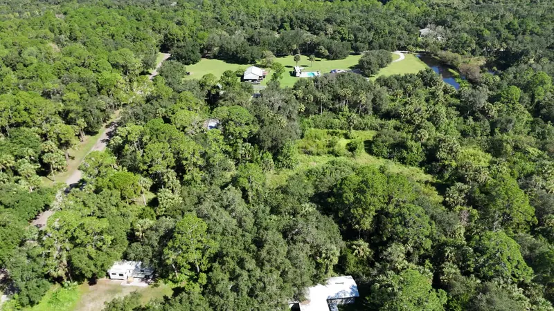
From above. At the gate. On the ground.
Thirty seconds of actual property footage, site photographs and a county-map view. Press play when you are ready.
Open the full-screen video page and scene guide ↗
The film could not load. Open the wide video directly, or try again on a stronger connection.
Actual footage with music and added sound effects, not recorded on-site ambience. Aerial views include neighboring land and improvements. The parcel outline is approximate and is not a survey.
Music: “Clear Air” by Kevin MacLeod (incompetech.com), licensed under CC BY 4.0. Edited for length and mixed for this film. Sound effects from Mixkit.
The film opens over the wooded property area, shows the entrance, and moves to a county aerial with the approximate parcel outline. It returns to a second drone view and photographs of remaining structures, then closes with Mo’s contact details. The former residence has been removed; other structures remain. On-screen information lists the $299,999 asking price and 5.24 county legal acres, compared with approximately 5.21 GIS acres, subject to survey. There is music but no spoken narration.
The property, as it is.
Offered as vacant land. The former residence has been removed; other structures remain, with condition and permitted use unverified.
Understand the outline.
The outline belongs to this county-map view, not to every improvement visible in the drone footage.
5.24 acres per the county legal description. GIS estimates approximately 5.21 acres. Acreage and boundaries are subject to survey.
Parcel ID06-20-32-301-004E-0000
County imagery may show former improvements. The former residence has been removed. This graphic is not a survey, wetland delineation, flood determination or building approval.
Good questions come before plans.
Start with the available records, then verify the parcel against the use you have in mind. The listing is not a promise of buildability.
A-5 zoning and Rural-5 future land use are subject to county review for a proposed use. Wetlands, flood conditions, boundaries and buildability require parcel-specific verification.
County records document well and septic capping in 2025. An FPL letter documents meter and service-wire disconnection. Current utility service and system reuse are unverified.
Access is via a private road, with road and utility easements described in title records. Confirm gate access before visiting. Remaining structure condition and permitted use are unverified.
Have a specific use in mind? Ask Mo for the available property records and discuss the next verification steps before making assumptions.
Request the details ↗A-5 zoning and Rural-5 future land use do not, by themselves, establish approval for a particular project. Boundaries, wetlands, flood conditions, access, well/septic requirements and the proposed use need parcel-specific verification with the appropriate professionals and agencies.
Current operation and reuse are not verified. County records document well and septic capping in 2025, and an FPL letter documents meter and service-wire disconnection. Confirm requirements and costs for the intended use before relying on existing infrastructure.
The county legal description shows 5.24 acres; the GIS estimate is approximately 5.21 acres. Neither the aerial outline nor the GIS measurement replaces a survey. Acreage and boundaries are subject to survey.
Please arrange an appointment with Mo first. Access is by private road, and gate access must be confirmed before a visit. Do not enter the property without permission.
One property. A direct conversation.
Ask for the available records, talk through your plans, or arrange an appointment to visit 1707 Kimmie Kay Drive.
Mo Mufti, REALTOR®
LPT Realty, LLC
No unaccompanied visits. Confirm private-road and gate access with Mo before going.
Listing information checked September 28, 2026. MLS G5118335. Price, availability and property information are subject to change and verification. Photographs and video do not show every part of the parcel or establish site conditions.
Explore Mo’s other listings and work ↗